Google Maps, like Chromebooks earlier today, had a couple of big announcements for upcoming features that we’ll look forward to. For those into cycling, prepare for improved route information. For those into location sharing through Maps, a new notification option is here. And for those into seeing fancy visuals in results, you get something too.
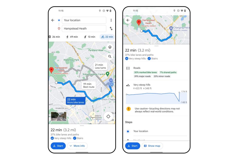
The cycling option for route planning has been in Google Maps for some time now, but Google says that it is adding a way to easily compare different routes, a clearer understanding of car traffic, and if there are stairs or steep hills. There’s soon to be a highly detailed breakdown of specific routes, like if you’ll hit major roads or on a local street.
If you use Google Maps for location sharing (you should, it’s awesome), Google is adding an option that will ping you with a notification once someone arrives at a destination. So if someone is sharing their location and headed to a concert or a house or restaurant or on a hike, you can add that address and a notification will pop-up when they get there. You can also set a location to know when they’ve left that spot.
And finally, Google is adding aerial views of nearly 100 iconic landmarks that you can see in Maps listings. When you look for the world’s most popular landmarks in places like New York, San Francisco, Tokyo, or London, tapping into the photos section will show these fancy new aerial views, assuming they have them. Neat.
Aerial views and location sharing notifications are two features that are rolling out now on Android, iOS, and desktop. The new cycling info is launching “in the coming weeks.”


Collapse Show Comments3 Comments